
Helgoland Roads
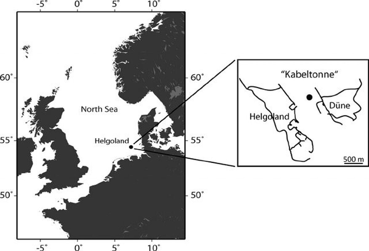
Kabeltonne Helgoland (English: Helgoland Roads) is a long-term North Sea sampling site of the Alfred Wegener Institute (AWI), Helmholtz Centre for Polar and Marine Research, Biologische Anstalt Helgoland (BAH). At this site, located off the island Helgoland in the German Bight at 54° 11.3′ N, 7° 54.0′ E (Fig. 1), the North Sea is exceptionally well-studied: Every day since 1962, researchers have visited Kabeltonne to take water samples and measure temperature, salinity, visibility depth and other parameters.
Why is it called Kabeltonne?
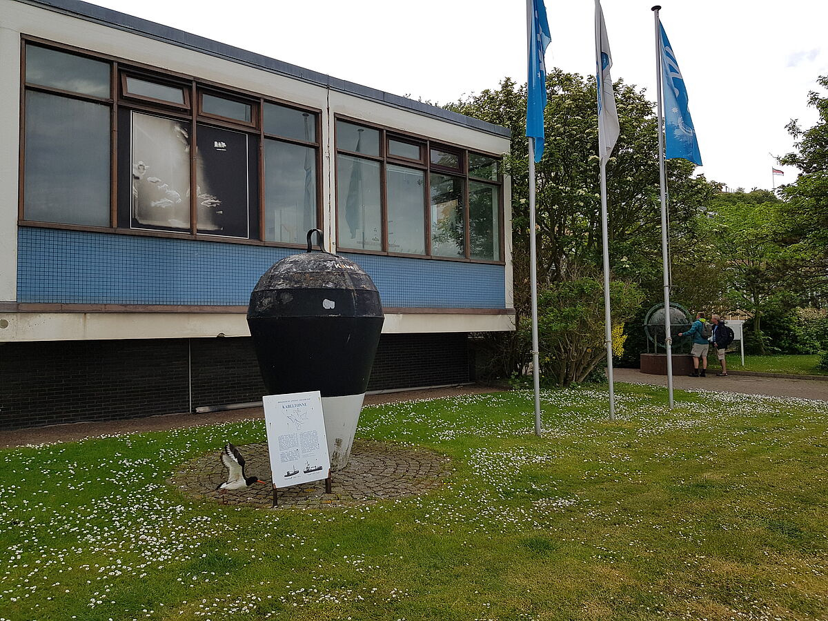
To make sure water samples and measurements were taken at the exact same site every day, researchers chose a location marked by a large black metal buoy. Originally, this buoy (German Boje, or Tonne) had been deployed to mark the location of an undersea cable (Kabel) that connected the islands Helgoland and Düne. The signal was meant to prevent boats from anchoring at this site.
Today, the original Kabeltonne buoy is no longer needed to mark the sampling site: thanks to GPS, research vessel Aade can always find its position. The buoy was brought to land and is now displayed in front of the BAH institute (Fig. 2).
Literature und further links:
- Pizzetti I, Fuchs BM, Gerdts G, Wichels A, Wiltshire KH, Amann R. Temporal variability of coastal Planctomycetes clades at Kabeltonne station, North Sea. Appl Environ Microbiol. 2011;77(14):5009–5017.
- Wiltshire, K. & Kraberg, A. Bartsch, I., Boersma, M., Franke, HD., Freund, J. Gebühr, C. Gerdts, G. Stockmann, K. A. Wichels 2010 Helgoland Roads, North Sea: 45 Years of Change Estuaries and Coasts https://doi.org/10.1007/s12237-009-9228-y
- 50 Jahre Helgoland Reede Langzeitdatenreihe - Der Jubiläumsfilm